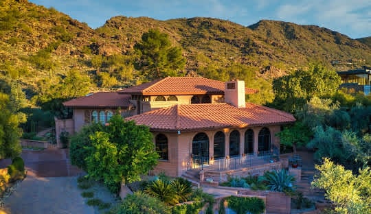
Mummy Mountain is an iconic landmark defining Paradise Valley. It is so beautiful that homes surrounding it command a higher price. As a result, it is in the middle of some of the most desirable neighborhoods in Paradise Valley.
Where Is Mummy Mountain?
Mummy Mountain is in the center of Paradise Valley. It is bordered by Lincoln Drive to the south, Tatum Blvd to the west, Doubletree Ranch Road to the north, and 64th St to the east. It is also bounded by the Phoenix Mountain Preserve to the west. Its sister mountain, Camelback, is to the south of Lincoln Drive.
How Did Mummy Mountain Get Its Name?
Mummy Mountain was originally called Windy Gulch. In the 1940s, a prospector named Charlie Mieg realized that this was not an attractive name. Charlie had bought the Van Benscoten Ranch with bordered the mountain. He wanted to develop it into parcels and sell it to people moving to the area. Charlie was one of the first real estate agents in Paradise Valley. , a Swiss by birth, prospered in banking and real estate in New York city and later in Florida, before moving to Arizona in the 1930s. He prospected for gold and other minerals through the Bradshaw Mountains, and spent much time at the Bagdad mines.
One morning, as he was riding along the dirt road which would later become Shea Boulevard, he realized that the mountain looked like an Egyptian mummy lying down. Since he owned the mountain, he was able to change its name. Today, the mountain has a park and a development that bear its name. (Source: Town of Paradise Valley)
Can You Hike Mummy Mountain?
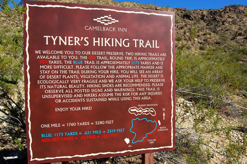
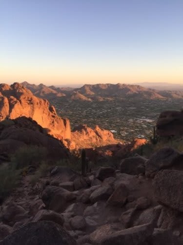
You can hike Mummy Mountain, but it is not easy. The trail is not paved, and requires hand-over-hand scrambling in some areas. Wear good hiking boots, perhaps even hiking gloves and bring hiking poles. Take your time, and bring plenty of water and snacks.
Start at the northern end of the Camelback Inn. Notify the front desk so they don’t tow your car. Begin the hike by walking through the fake western town titled "Mummy Mountain." Cross the bridge to "Tyner's Hiking Trail." The blue trail will take you to wooden bench at the high-point of the loop. To reach the top, follow a “goat trail” up a gully. Veer left and climb the ridge. The first peak is not the top. Head northeast to the peak, where you’ll see some utility structures and a solar panel. The views from the top only costs you the sweat equity it takes to hike there.(Source: Hike Arizona,)